Dean Stuart Campbell (known as the Squire of Dark Corner) conducted the tour. He is an author, lecturer, photographer, story teller and tour guide, Dean Campbell has the perspective a native son whose maternal and paternal ancestors were early settlers. Campbell was the first to delineate the Dark Corner, the infamous mountain region in northern Greenville County.
For years the Dark Corner was difficult to pinpoint. When local folks were asked the location of Dark Corner, the usual answer was, “Just a little piece further down the road.”
Over time, the entire northwest corner of South Carolina became know as the Dark Corner.
Dean Campbell’s Dark Corner is much more specific, confined entirely within the boundaries of Greenville County. It is generally defined as that area north of Highway 11 between Highway 14 and Highway 25. The land includes rolling foothills and the rugged Blue Ridge escarpment. The Cherokees called it the Blue Wall.
The first settlers were primarily Scots-Irish, granted their lands from the King of England before the Revolutionary War. Families of many of those pioneers still reside in the area, living on the original tracts of land.
Dark Corner was so named because there were few roads in and out. The land was densely forested. Farmsteads were away from the roads, hidden by the trees.
The people who lived in Dark Corner were good, hard-working people. Making and selling liquor was a legal way of earning money. Many residents of Dark Corner have made their own alcoholic beverages for generations, turning their corn and rye into whiskey.
President George Washington was the first to appoint High Sheriffs to collect taxes on homemade liquor. These officers were called Revenuers. The first sheriff dispatched to Dark Corner was shot and killed.
The people of Dark Corner felt that the government was unreasonable for imposing such laws. Government agents charged with enforcement of taxes and, later, prohibition, were looked on as enemies. Strangers who entered Dark Corner were regarded with suspicion.
An intruder literally took his life into his own hands. Folks who operated the stills, hidden in the laurel thickets, hollows, and coves along mountain streams, looked on Revenuers as fair game.
Troy Alverson lived on Von’s Creek near the old road that went from Tryon through Dark Corner. One day a wagon and seven men stopped at the Alverson cabin. The wagon was loaded with axes, picks, and guns. They asked Mr. Alverson if this was the road to Dark Corner.
“Do you fellers know anyone there?” he asked.
“No,” they answered.
They were advised that it was dangerous to go prowling around if they didn’t know anyone in the area.
One of the men spoke up, “We’ll take our chances. We’re Revenue Officers.”
Mr. Alverson shook his head, “Good luck, fellows.”
The seven men were never heard of again.
Dark Corner’s reputation has improved. Once known as an area of outlaws that rivaled the Old West for its gunfights and knife fights, these 150 square miles of rugged mountain country surrounding Glassy Mountain are now known as a delightful place to visit. From Pretty Place at Camp Greenville to the Greenville Watershed, from Campbell’s Covered Bridge to the Poinsett Bridge, the Dark Corner is rich in wonders to behold.
Dean Campbell says there are still moonshiners in the area.
Bridges in the Dark Corner
Klickety-Klack Covered Bridge
Built in 2000
This 21st century open sided covered bridge was built as a gift to visitors as they enter the Dark Corner.
Poinsett's Bridge
It is the oldest bridge in SC. It was built in 1820. It was on the Old State Road. a toll road from Charleston, SC to Asheville, NC. Joel Poinsett laid out the upper end of the road. The Poinsettia was named for him.
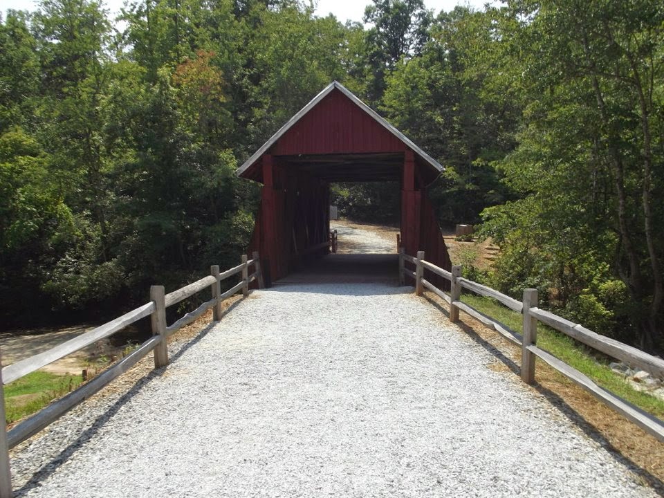
Campbell's Covered Bridge
Built in 1909 - spans the babbling waters of Beaverdam Creek near Gowensville.
You can find information about this area at w


